해마다 여름철이 되면 엄청난 양의 비와 강풍을 동반한 열대성 저기압이 지구 곳곳을 습격,공포에 떨게 한다.우리가 태풍이라 부르는 열대성 저기압은 발생지역에 따라 사이클론(인도양와 오스트레일리아 부근 남태평양),허리케인(동태평양과 대서양 부근)등 다양한 이름을 가지고 있다.다음 글은 뉴올리언스 지역을 알리는 사이트에 게재된 기상관련 정보에서 발췌한 것이다.대서양 멕시코만 연안에 위치한 뉴올리언스주(州)는 오랫동안 허리케인의 피해를 입어왔기 때문에 허리케인 발생시기,경보체계,대피방법 및 재난복구요령 등에 관한 연구가 잘 이루어지고 있다.
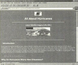
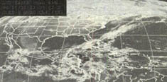
뉴올리언스의 사이트는 http://www.yatcom.com/neworl/vno.html이며,허리케인에 대한 정보를 얻을 수 있는 곳은 http://www.yatcom.com/neworl/weather/hurricane.html이다.이 사이트는 허리케인과 토네이도에 대한 설명,멕시코연안 지역의 취약성,대피방법 등과 함께 최신 인공위성 사진도 자세하게 소개하고 있으며,몇몇 개의 주요한 사이트들을 연결해 놓았다.
허리케인이란 무엇인가?
허리케인은 열대성저기압으로 알려져 있는 기상현상 중 하나다.허리케인이라는 단어는 서부 인디언들로부터 유래한 것으로 '폭풍(bigwind)'을 뜻한다.허리케인은 대서양의 따뜻한 열대 해수면 위에서 형성돼 채 성숙하지 않은 폭풍으로부터 시작된다.폭풍이 좀 더 성장하면 '열대성 저기압'으로 분류되고,국립 허리케인 센터에 의해 번호가 주어진다.이 열대성 저기압 내 바람의 세기가 시속40마일이 되면 '열대성 폭풍'으로 분류되며 이름이 주어진다.그리고 바람의 세기가 시속1백20k에 이르면 드디어 허리케인이 된다.
허리케인은 중심부의 '눈'-구름도 없고,비교적 고요한-을 바람이 둘러싼 구조다.눈 주위에는 폭풍구름이 반시계 방향으로 운동하며 감싸고 있다.바람과 비와 구름으로 이루어진 이러한 벽(eyewall)이 폭풍에서 가장 파괴적인 부분이다.
사실 폭풍의 눈은 벽에 의해 만들어지는 것으로,빠르게 회전하는 구름벽이 중심부의 압력을 낮추어 그안에 있는 모든 구름을 뽑아낸다.
대개 허리케인은 날씬한 모양의 폭풍으로,눈으로부터 10-1백km에 이르는 강한 바람을 동반한다.물론 눈으로부터 3백마일 떨어진 곳까지 강풍을 불게 하는것도 있다.이러한 것들로 인해 멕시코만 연안에 사는 사람들은 허리케인을 두려워 하는 것이다.
멕시코만 연안지역의 취약성
연안지역이 취약한데는 두가지 주된 지리하적 이유가 있다. 첫째는 뉴올리언스가 태풍의 경로인 열대지역 바다에 근접해 있다는 것이고,둘째는 멕시코만의 해수온도가 대서양보다 높아 태풍을 끌어들인다는 것이다.멕시코만 전체가 자석과 같아 성장을 위해 따뜻한 지역을 찾아 이동하는 태풍을 끌어들인다.
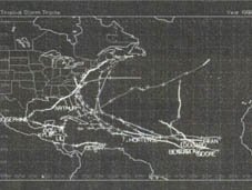
멕시코만 연안,특히 루이지애나와 미시시피는 허리케인으로 인해 혹독한 시련을 경험해 왔다.1965년 이후 이 지역에 수많은 태풍들이 지나갔지만,특히 3번에 걸쳐 매우 위험한 태풍의 공격을 받았다.1965년 허리케인 벳시(Betsy)는 플로리다 일부를 강타하고,키 지역(Keys)을 휩쓸어버린 후 미시시피 강어귀까지 곧장 올라와 뉴올리언스사와 시남부의 저지대 마을들에 홍수를 일으켰다.
1969년 허리케인 카밀레는 시속2백마일이 넘는 강풍과 25피트 이상의 해일을 동반한 채 미시시피만 연안에 도착해 연안지역의 거의 모든 것들을 파괴했다.1992년 허리케인 앤드류는 플로리다 남부를 황폐화시킨 후 뉴올리언스 서부해안에 도착했고,여기서 생성된 많은 토네이도(땅에 햇빛에 의해 달구어져 육지에서 발생하는 회오리:편집자)로 인해 이 지역이 광범위하게 파괴됐다.
허리케인 발생시기는 언제인가?
공식적으로 알려진 허리케인 발생시기는 6월1일부터 11월30일까지다.이 시기의 초반이나 후반에도 폭풍이 발생하기는 하지만,늦여름에서 초가을까지가 이 지역이 가장 취약한 기간이다.허리케인에게는 여성의 이름이 사용됐다.태풍이 마치 여자처럼 전혀 예측할 수 없기 때문이었다.그러나 1991년 이래 현재는 남녀의 이름이 모두 사용되고 있다.
대피할 것인가? 견뎌낼 것인가?
허리케인이 자주 발생하는 지역에는 세 종류의 사람들이 있다.첫째는 그 지역에 폭풍경보가 발령되자마자 떠나버리는 사람들이다.뉴올리언스에 사는 많은 사람들은 태풍경보를 댈러스나 세인트루이스로 떠나는 2-3일간의 휴가로 여긴다.그들은 가옥 안전점검을 한 후,짐을 꾸리고 목적지로 향한다.두번째는 어떠한 상황에서도 절대 집을 떠나지 않는 사람들이다.아마도 가까운 곳에 사시는 어머니께서 한사코 집 떠나기를 거부하시기 때문에 어머니의 안전을 위해 함께 있을 필요가 있다고 생각했거나,아니면 정말 무서운 폭풍을 겪어본 적이 없어서 앞으로 시작될 일들에 대해 모르기 때문일 수 있다.우리들 중 대다수는 이런 두 극단의 중간쯤에 속해 있다.멕시코만에서 불어온 폭풍이 피해를 입힐 수도 있다는 것을 알지만,그렇다고 마을을 떠나기도 원치 않는다.사람들은 일상생활의 리듬을 깨뜨리지 않고서도 가족들의 안전을 지킬수 있도록 하기 위해 중도를 채택하려고 노력한다.
견뎌내기
어떤 이유에서건 폭풍이 몰아쳐도 그냥 집에 남아있기로 했다면 명심해야 할 일은 모든 것은 상식적으로 판단해 결정하라는 것이다.여기에 도움이 될만한 몇가지 짧은 정보가 있다.
혼자 남아있지 말라!
위급한 상황이 발생할 때 도움을 요청할 필요가 있을 뿐 아니라,폭풍이 통과하며 발생하는 일들을 철저히 살펴야 한다.만약 폭풍이 끝나기 1-2일 전까지 견디고 있는 상태라면 무척 피곤할것이다.잠을 자려고 한다면 잠자는 동안 눈뜨고 있을 누군가가 필요할 것이다.
폭풍의 자취를 잘 파악하라.
이것이 작은 AM라디오와 여분의 건전지를 사두어야 하는 이유이다.TV와 라디오 방송국은 폭풍중에도 전력을 잃지 않는 이상 계속 방송을 하며,예비전력도 쉽게 연결할 수 있다.폭풍이 심하게 몰아칠 때면 AM라디오는 여러분과 바깥세계를 연결하는 가장 강력한 도구가 될 것이다.
이웃집에 물이 불어나는지를 살펴보라.
만약 제방이 무너지거나 수문이 위험하다면 순식간에 큰 피해를 입게 될 것이다.(이 경우라면)고지대로 대피할 준비를 하거나,가옥의 높은 곳으로 올라가야 한다.폭우로 인한 잠깐동안의 홍수는 허리케인이 불어닥치는 동안 발생할 수 있는 바다,강,호수 등의 해일만큼 걱정스러운 것은 아니다.
가옥의 상태를 점검하라.
창문이 깨지면 판자를 대는 등의 준비를 하라.
토네이도 소리에 귀를 기울이라.
대부분의 사람들은 토네이도를 보기 전에 소리부터 듣게 될 것이다.토네이도 발생지역이라면 더욱 그렇게 해야 한다.
미리 잠을 자두어라.
정신나간 소리처럼 들릴지 모르지만, 어차피 모든 상황이 바람과 비 속에서 일어나는 일이라면 바로 지금이 잠시 잠을 자둘 떄다.집안의 어른들은 교대로 잠을 자둬야 하며,누군가는 반드시 폭풍과 지역적인 상황을 살펴보아야 한다.대피해야 할 경우를 위해서도 쉬어야 할 필요가 있다.폭풍이 지나간 후에는 틀림없이 주위를 정리하느라 바쁠 것이기 때문이다.
아이들을 생각해서 적극적인 태도를 취하라.
아이들은 마치 동물들처럼 두려움에 대한 본능적인 감각을 가지고 있다. 아이들이 두려워하는 것보다 더 두렵게 만들면 안된다. 평온하면서도 쾌활함을 유지해 더 이상의 문제를 일으키지 말라.
What Is A Hurricane?
Hurricanes are part of a family of weather systems knows as"tropical cyclones."The word hurricane is from the West Indian word hurricane,meaning "big wind."A hurricane begins its life as a disorganized storm system which forms over warm,tropical waters in the Atlantic.When the storm system became more organized,it is dassified as a "tropical depression,"and given a number by the National Hurricane Center.If the winds in a tropical depression grow in intensity to 40mph,it is re-classified as a "tropical storm,"and it receives a name.When the winds in the storm reach 75mph(120kph),the storm is upgraded to a hurricane.
The winds of a hurricane are structured around a central"eye",which is an area that is free of clouds andrelatively calm.Around this"eye"area,storm clouds wrap in a counter-clockwise motion.This"eyewall"of clouds,wind and rain,is the most destructive part of storm.In fact,it is the eye wall the creates the eye,since the repid spinning clouds in the wall reduce the pressure in the eye and suck out any clouds that may be there.
Hurricanes are usually compact storms,with maximum wind velocities extending out 10to100km from theeye.Of course,one can still experience gale-force winds as much as 300 miles out from the eye,which is why everyone in the Gulf Coast area is concerned when a hurricane comes a-calling.
Gulf Coast Vulnerability
There are two main geographic reasons the Gulf Coast is vulnerable.First,our proximity to tropical water pust us in the path of the storms.Second,the water of the Gulf sre warmer than those of the Atlantic,which is attractive to the storms.The entire Gulf region is a magnet for storms looking for a warm place to grow.
The Gulf Coast,particularly Louisiana and Mississippi,have learned some hard lessons about hurricanes.Since 1965,the area has been hit hard by three very serious storms,as well as a number of minor ones.In 1965,Hurricane Betsy,after hitting the trip of Florida and wiping out the Keys,came straight up the mouth of the Mississippi and flooded the city of New Orleans and the low-lying parishes south of the city.In 1969,Hurricane Camille came in on the Mississippi Gulf Coast,all but deatroying everything on the coast with its 200+ mph winds and 25+foot tidal surge.In 1992,Hurricane Andrwe,after causing a devastating amount of damage in Southern Florida,came ashore west of New Orleans,spawning tornadoes that contributed to the massive amount of destruction.
When is Hurricane Season?
Hurricane season offcially runs from June 1st to November 30th.While storms develop both early and late in the season,the late summer to early fall tends to be time when the are is most vulnerable.Names for this year hurricanes Time was when all hurricane were given women's names.The notion was that the storms are totally unpreictable,just like women.That was changed in 1991,and now both male and female names are used.
Evacuation versus "Riding the Storm Out"
There are three kinds of people who live in huricane-prone parts of the country.The first is those folks who hit the road as soon as a hurricane warning is issued for their area.Many folksin New Orleans decide that a hurricane warning is a great time for a vacation to Dallas or St.Louis for a couple of days.They batten down the house,pack up,and head out.The second type of resident here is the family that never wants to leave their home under any circumstances.May be your momma lives around the corner and she refuses to leave her home,so you figure you need to hang around for her sake.Maybe you've never been through a bad storm and you just don't know what you're getting into.In-between these two extremes are the majority ofus.We know that that stormin the Gulf could possibly generatea world of hurt,but we don't want just to up and leave.We try to strike a balance that will keep our families safe with a minimal disruption of the house hold routine.
Riding it Out
OK,you've decided for whatever reason that you're going to ride the storm out at home.The key thing to remember is to exercise good common sense when making decisions,Here are a few tips to help that process along:
Don't tride the storm out alone!Notonly may you need help in case something serious happens,you also have to monitor what's going on throughout the storm's passing.If you're been preparing for the storm for the last day or two,you're probably tired.You're going to want to get some rest,so you'll need to have someone else keeping an eye on things while you're sleeping.
Follow the track of the storm closely.This is why you bought that little AM radio and several extra batteries.The TV and radio stations will stay on the air throughout the storm,unless they lose power,and it's easier for a radio station to goon to back up generators.If the storm hits hard,AMradio will most likely be the strongest link you'II have to the outside world.
Monitor rising water in your neighborhood.If a levee breaks or a floodgate is not secured,you could be in a world of hurt very quickly.Be prepared to evacuate to higher ground,or to head to higher points in the house.Flash flooding from large amount of rain fall is not much of a concern during a hurricane as tidal surge from the gulf,river,and the lake.
Monitor the condition of your house.Beready to board up windows that get broken,etc.
Listen for tornadoes.Yoy'll most likely a tornado before you'll see it.More on the Tornadoes section.
Try to get some sleep.This may sound crazy,but if all that's happening is that you're getting wind and rain,now is the time for you to catch a nap.Adults in the house should sleep in shifts,so someone is always monitoring the storm and the local conditions.You'll need some rest,in case you do have to evacuate,and certainly because you'll be busy cleaning up after the storm passes.
Keep a positive attitude for the children.Kids can sense fear like animals do.Don't make them tore afraid than they already are.Stay calm,and cheerful so they don't become an additional problem.